
SATSOFT
SATSOFT is used for assessment of antenna coverage and gain, development of contoured beam and multi-beam antenna designs, and many other tasks required for payload design and regulatory filings.
Features
- Quickly select countries or draw polygons to use as coverage area definition
- Synthesise contoured and spotbeams with or without pointing error from reflector or array antennas
- Plot pattern contours and create performance tables of directivity, EIRP, G/T
- Import measured or predicted antenna patterns to use in your analysis
Values
- Efficient planning, designing, and marketing of communication satellite payloads
- Conduct antenna trade-off studies
- Prepare documents for ITU regulatory filings
- Intuitive user-interface
- Easy interface to POS and GRASP
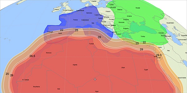
Pattern visualisation and coverage polygons
SATSOFT is designed for communication satellite coverage planning, analysis, and preliminary antenna layout. Supplier-furnished antenna patterns can be imported and managed with the Pattern Data Manager and subsequently inspected and visualised on a world map, while coverage polygons can be defined and displayed on the map. Polygons, whether they are defined from political borders or by free-hand drawing, are easily enlarged to give a realistic account for any antenna or spacecraft pointing error.
Large selection of antenna models
SATSOFT offers import of antenna patterns and simple, fast modelling using Gaussian beams with prescribed footprints. The optional Payload Antenna Planner (PAP) add-on provides physical optics (PO) analysis of array-fed offset reflectors and shaped reflectors as well as analytic direct radiating phased arrays, taking the design and analysis one step closer to real payload performance. Any of the above models can be used to synthesise and optimise antenna beams.
Postprocessing with Performance Tables and Delta Pattern
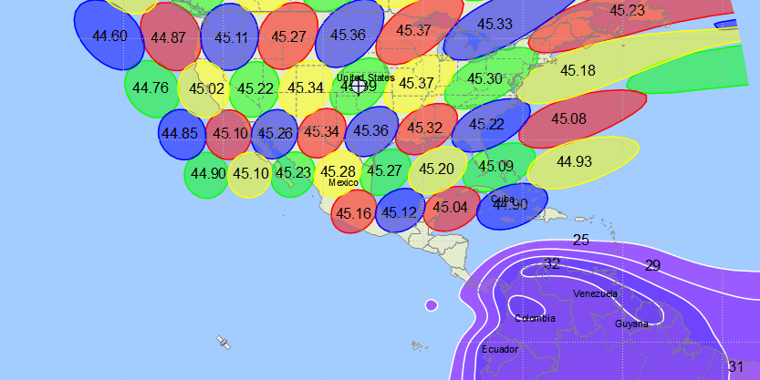
Antenna patterns can be inspected and post-processed in several ways in SATSOFT. Cities selected from the supplied city database can be added to the map, including a pointing error box, and the Performance Table Manager is easily applied to generate tables for all antennas in a given project, displaying the performance on synthesis stations and/or cities. This includes parameters such as directivity, EIRP, XPD, min/max as a function of pointing, among others. Similarly, any two antenna patterns can be compared directly by generating their difference in dB using the Delta Pattern feature.
Exchange data and designs with other TICRA programs
SATSOFT seamlessly interfaces with other TICRA programs. Pattern grids computed from detailed antenna analyses in TICRA Tools (GRASP, POS, QUPES, ESTEAM and CHAMP 3D) can readily be imported into SATSOFT. Similarly, multi-feed and shaped reflector antenna designs and coverages set up in SATSOFT using the Payload Antenna Planner add-on can be exported to complete and ready-to-run POS and GRASP projects. This considerably speeds up the design workflow.
Pattern contour and polygon export
Pattern contours and polygons can be exported from SATSOFT in numerous formats. Displayed pattern contours can be exported to ITU GXT format, while they can also be exported in KML format for display in Google Earth with its vast rendering capabilities. Similarly, coverage polygons can be exported for use in other SATSOFT projects, with POS and with STK, among others.
Contact us

Uğur Meriç Gür
- Technical Sales Engineer
- +45 3312 4572
- info@ticra.com